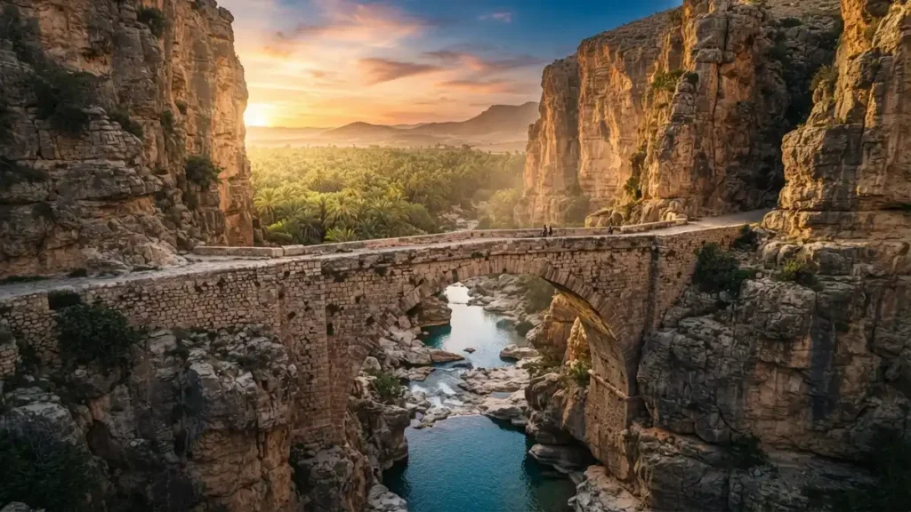
TL;DR: Al-kântara (from the Arabic al-qantarah, meaning “the arched bridge”) is a foundational linguistic and architectural term spanning the Mediterranean and North Africa. It gives its name to Algeria’s “Mouth of the Desert” gorge, Spain’s greatest Roman bridge, Egypt’s Suez Canal gateway, and Sicily’s volcanic basalt canyons.
Have you ever wondered why a desert oasis in Algeria, a towering granite viaduct in western Spain, a strategic crossing over the Suez Canal, and a volcanic canyon in Sicily all share the exact same name? Across four countries and two continents, these dramatic landmarks trace their identities back to a single historical word: al-kântara.
To casual travelers, the name might look like a coincidence of geography. In reality, it is a living footprint of medieval engineering, ancient trade routes, and linguistic exchange across the Mediterranean basin. In this guide, you’ll discover the origins of the term, explore the four remarkable places that bear its name, and learn how ancient builders constructed stone arches that survived for two millennia.
Quick Overview: Key Facts at a Glance
- Literal Meaning: Derived from the classical Arabic al-qantarah (القنطرة), translating directly to “the arch,” “the vaulted bridge,” or “the aqueduct.”
- Geographic Reach: Appears as a major place name in Algeria (El Kantara), Spain (Alcántara), Egypt (El Qantara), and Italy (Gole dell’Alcantara).
- Architectural Significance: Medieval Arab and Berber chroniclers reserved this title for monumental stone bridges—often of Roman origin—whose engineering inspired awe.
- Cultural Symbolism: Beyond physical infrastructure, the word represents transition, safe passage across hostile terrain, and spiritual reconciliation in classical literature.
- Modern Legacy: Today, these sites rank among the most striking geological and archaeological destinations in the Mediterranean and North African worlds.
What Does Al-Kântara Actually Mean in History and Language?
Definition: Al-kântara is the French and English historical transliteration of the Arabic noun al-qantarah (القنطرة), formed by combining the definite article al- (“the”) with qantarah (“arched bridge” or “high vault”). In historical geography, the term designates a major masonry crossing that serves as a bottleneck for trade, military movement, and cultural exchange.
Why did a basic engineering word become the permanent proper name for entire towns, rivers, and mountain passes? During the early medieval period, most river crossings consisted of shallow fords, seasonal timber planks, or rope ferries. When Arabic-speaking travelers, scholars, and merchants encountered massive cut-stone Roman viaducts spanning deep gorges, they didn’t just see a local road. They saw a landmark so extraordinary that the structure itself defined the entire region.
Linguists trace the root q-n-t-r back through Semitic and classical Mediterranean languages, where it originally described the curve of a bow or a masonry vault. Over centuries of Moorish governance in the Iberian Peninsula and Sicily, the Arabic word merged seamlessly into European Romance languages. In Spanish and Portuguese, it became Alcántara; in Sicilian and Italian, Alcantara; and in North African French cartography, El Kantara.
Even today, the root word remains active in everyday vocabulary. In Arabic, the plural form qanatir refers to major dam barrages along the Nile, while the related weight measurement qintar (the origin of the English and French quintal, or hundredweight) historically denoted a load heavy enough to test the strength of a bridge arch.
How Did One Arabic Word Name Iconic Landmarks Across Four Countries?
As ancient trade routes expanded across North Africa, the Levant, and Southern Europe, geography dictated where civilizations could connect. Mountain ranges, turbulent rivers, and desert chasms blocked carotid trade arteries until engineers bridged the gaps. Because these crossings controlled the flow of gold, salt, silk, and soldiers, settlements naturally grew around them.
To understand how the legacy of al-kântara manifests across different regions, it helps to compare the major historical landmarks that inherited this name. Each site pairs an ancient stone bridge with an unforgettable natural landscape.
| Landmark & Location | Local Spelling | Primary Feature | Historical Origin | Why It Was Named “The Bridge” |
|---|---|---|---|---|
| El Kantara Gorge (Biskra/Batna, Algeria) | El Kantara / Al-Kântara | Narrow limestone canyon connecting the Aurès Mountains to the Sahara | Roman military outpost (Calceus Herculis), 2nd–3rd century CE | A single-arch Roman bridge spanning the river inside the canyon gateway |
| Bridge of Alcántara (Extremadura, Spain) | Alcántara | Six-arch granite Roman bridge soaring 71 meters above the Tagus River | Built between 104 and 106 CE under Roman Emperor Trajan | Moorish geographers marveled at its dry-stone masonry and named the town after it |
| El Qantara Twin City (Ismailia, Egypt) | El Qantara (Al-Qantarah) | Strategic crossing spanning both banks of the Suez Canal | Ancient Pharaonic Way of Horus and Mamluk caravan bridge | A medieval stone bridge crossing the historic water channel between Sinai and the Nile Delta |
| Alcantara Gorge (Sicily, Italy) | Gole dell’Alcantara | 50-meter-high volcanic basalt canyon carved by an icy mountain river | Prehistoric Mount Etna lava flows; named during 9th–11th century Arab rule | Named by Arabic-speaking Sicilians after an arched Roman-medieval bridge over the river |
| Bab El-Kantra (Constantine, Algeria) | El-Kantra | Monumental gateway bridge spanning the sheer Rhummel Gorge | Roman multi-tiered aqueduct and bridge, rebuilt in the Ottoman and French eras | Served as the primary northeast bridge entrance into the cliffside city of Constantine |
The Iberian Masterpiece: Spain’s Bridge of Trajan
If you want to see the sheer scale that inspired medieval chroniclers, look no further than western Spain near the Portuguese border. According to Encyclopaedia Britannica’s historical profile of Alcántara, the Roman architect Gaius Julius Lacer constructed this monumental six-arch bridge over the Tagus River between 104 and 106 CE on the orders of Emperor Trajan.
Lacer was so proud of his work that he carved an inscription beside the roadway declaring his bridge would stand “for eternity throughout the ages of the world.” He wasn’t exaggerating. When Moorish chroniclers like al-Idrisi documented the structure centuries later, they regarded it as one of the architectural wonders of the known world, permanently replacing its Latin name with the Arabic title for “The Bridge.”
Why Is Algeria’s Gorge Known as the Mouth of the Desert?
While Spain claims the tallest Roman viaduct, the landmark most frequently spelled al-Kântara in 19th- and 20th-century travel literature lies in northeastern Algeria. Situated along the border of Batna and Biskra provinces, this dramatic limestone rift slices straight through the rugged Aurès Mountains. Local inhabitants have long called this natural cleft Foum es-Sahra—the “Mouth of the Desert.”
Imagine traveling south from the high, chilly plateaus of Constantine during winter. On the northern side of the mountain wall, the air is biting, the rocks are slate-gray, and snow often dusts the peaks. Then, you walk just forty meters through a razor-thin gorge over an ancient Roman stone arch, and the world transforms before your eyes.
A Real-World Example of Microclimate Contrast
The moment you cross to the southern side of the bridge, the towering limestone cliffs block the cold northern winds completely. Stretching below you is a glowing sea of more than 100,000 date palms watered by the Oued El Hai river, bathed in warm Saharan sunlight. Nineteen-century French writer and painter Eugène Fromentin famously described crossing this exact bridge as stepping directly from winter into summer in the span of sixty paces.
From Hercules to the Palmyrene Archers
Ancient legends claimed that the demigod Hercules kicked the mountain wall with his heel to split the rock open, giving the Roman settlement its classical name: Calceus Herculis (“The Shoe of Hercules”). Because every nomad caravan and military column moving between the Sahara and the Mediterranean coast had to squeeze through this single chasm, Rome fortified it heavily.
During the 2nd and 3rd centuries CE, the Roman army stationed detachments of the famous Legio III Augusta here alongside the Numerus Palmyrenorum—an elite unit of desert archers recruited all the way from Palmyra in Syria. These Syrian soldiers brought their own engineering skills and carving traditions to Algeria, maintaining the single-arch limestone bridge that later gave the surrounding oasis villages of Red Village (Village Rouge), White Village (Village Blanc), and Black Village (Village Noir) their shared Arabic name.
How Does the Engineering Behind Al-Kântara Bridges Defy Gravity?
How can a bridge built nearly two thousand years ago out of stacked stones survive raging flash floods, earthquakes, and modern traffic without steel rebar or Portland cement? Whether you examine the Roman arches in Algeria or the towering piers in Spain, the secret lies in pure compression mechanics.
Stone performs terribly when pulled apart under tension, which is why a flat stone slab snaps easily if spanned across a wide river. However, stone is virtually indestructible when squeezed together under compression. Ancient Roman and medieval Islamic engineers mastered the semicircular masonry arch to convert every ounce of downward gravity into outward and downward compression.
text          [ Roadway / Deck Load ]
        |||||||||       |||||||||
       v         v     v         v
             [ KEYSTONE ]
           /    \   /    \
         /  Voussoirs      \      <-- Wedge-shaped stones squeeze
       /    (Arch Ring)      \        tighter under heavy loads
     /                         \
  [ Pier / Abutment ]   [ Pier / Abutment ]
  (Bedrock Foundation)  (Bedrock Foundation)
How It Works: A 4-Step Breakdown of Stone Arch Mechanics
- Anchoring into Living Bedrock: Engineers first diverted shallow river channels or built watertight timber enclosures called cofferdams to pump water out of the riverbed. They excavated down to solid bedrock so the heavy masonry piers (pilae) could never sink into shifting mud or gravel.
- Shaping Hydrodynamic Cutwaters: Notice the triangular prows sticking out from the base of historic stone piers? Those are cutwaters (or starlings). Pointed upstream like the bow of a ship, they slice incoming floodwaters cleanly in two, preventing swirling whirlpools from scouring away the stones beneath the foundation.
- Erecting the Timber Centering: Before laying the arch, carpenters built a temporary hemispherical wooden scaffold called centering across the gap between two piers. Masons then carefully stacked wedge-shaped granite or limestone blocks, known as voussoirs, upward from both sides simultaneously.
- Dropping the Keystone: The arch remained unstable until the final central wedge—the keystone—was lowered into the apex. Once the keystone locked into place and the wooden frame was removed, gravity pulled the central wedge down, forcing every adjacent stone tighter against its neighbor in a self-locking ring.
In many classical structures, masons used dry-stone ashlar masonry (opus quadratum), cutting granite blocks so precisely that not a drop of mortar was needed between them. Wait—doesn’t lack of mortar make a bridge weaker? Actually, dry-fitted blocks allow microscopic movement during thermal expansion and minor seismic tremors, absorbing energy that would crack rigid modern concrete!
What Role Did the Egyptian Crossing Play in Global Trade and Warfare?
Shift your gaze eastward to the Isthmus of Suez, and you’ll find another place where a single bridge shaped world history. El Qantara (officially divided today into El Qantara West in Africa and El Qantara East in the Sinai Peninsula) sits roughly thirty miles south of Port Said along the Suez Canal. For over four thousand years, this narrow strip of firm ground between soggy coastal lagoons and desert dunes served as the primary land bridge between Africa and Asia.
In Pharaonic Egypt, armies and royal couriers marched through this corridor along the fortified Way of Horus (Haru), a string of mudbrick fortresses protecting the Nile Delta from eastern invasions. During the Mamluk Sultanate, rulers built a durable arched masonry bridge over the watery depression connecting Lake Manzala and Lake Ballah. Caravan merchants traveling between Cairo, Damascus, and Jerusalem used this bridge as their primary customs checkpoint and resting station.
From Caravan Bridge to Modern Megastructures
When the modern Suez Canal was excavated through the isthmus in the 1860s, the historic town was split right down the middle into eastern and western halves. Because of its vital position on the desert rail line to Palestine, it became a massive logistics hub for British and Commonwealth forces during World War I, and later saw intense combat during the 1967 and 1973 Arab-Israeli wars.
Today, the ancient spirit of the crossing lives on at an industrial scale. Just south of the city stands the El Ferdan Railway Bridge, the longest swing-span bridge on Earth, alongside the soaring Suez Canal Bridge (also called the Egyptian-Japanese Friendship Bridge), which carries vehicles seventy meters above the water so massive container ships can pass freely underneath. As documented in UNESCO’s World Heritage architectural archives, preserving historic transit corridors and monumental bridges remains essential to understanding how human civilizations exchanged science, agriculture, and art across continents.
How Did Sicily’s Volcanic River Inherit This Historic Name?
Can a river be named after a bridge while becoming even more famous for its geology? On the eastern coast of Sicily, just north of Mount Etna and a short drive from Taormina, flows the 52-kilometer Alcantara River. While tourists flock here today to wade through icy turquoise rapids, the river’s name is a fascinating relic of medieval Mediterranean history.
Roughly 8,000 years ago, prehistoric eruptions from Mount Mojo—a volcanic flank vent of Mount Etna—sent thick rivers of molten basaltic lava pouring down the valley. When this superheated magma collided with the freezing mountain water of the river, it cooled at breakneck speed. Instead of forming smooth rock, the rapid thermal contraction fractured the lava into towering vertical prisms, creating hexagonal and pentagonal basalt columns up to fifty meters tall.
The Arab-Norman Legacy in Sicily
When Arabic-speaking settlers arrived in Sicily during the 9th century CE, they introduced advanced irrigation networks, citrus groves, and sugar cane cultivation to the island’s fertile volcanic valleys. Along the lower reaches of this fast-moving river, near the present-day boundary between Calatabiano and Giardini Naxos, stood a robust arched bridge constructed using Roman and medieval Arab masonry techniques.
Locals began calling the structure al-Qantarah, and soon the name attached itself to the entire river (Wadi al-Qantarah) and the canyon above it. Even upstream near Mojo Alcantara and Castiglione di Sicilia, you can still walk across the medieval Ponte Saraceno (Saracen Bridge), a single-arch stone crossing built over lava bedrock that captures the exact blend of Norman and Arab engineering that shaped Sicily’s landscape.
What Is the Spiritual Meaning of the Bridge in Classical Tradition?
Why did medieval builders and writers treat bridges with near-sacred reverence? In the arid landscapes of the Middle East, North Africa, and the Mediterranean, a flash flood (sayl) sweeping down a dry riverbed (wadi) could trap travelers for weeks or sweep an entire merchant caravan to its death. Building a permanent stone bridge wasn’t just municipal infrastructure—it was an act of life-saving charity.
Under classical Islamic endowment law (waqf), wealthy patrons, sultans, and scholars frequently funded public bridges as sadaqah jariyah—a continuous charitable gift believed to bless the builder’s soul for as long as travelers, pilgrims, and animals crossed safely over the water. Inscriptions carved into medieval bridges across Spain, Algeria, and Anatolia often asked passing travelers to offer a quiet prayer for the stonemasons who laid the arches.
The Bridge of Reconciliation
Beyond physical bricks and mortar, the word carries a profound metaphorical meaning in classical Islamic theology and literature. In authentic prophetic traditions (Hadith, notably recorded by Imam al-Bukhari), Al-Qantarah describes an arched spiritual bridge situated between the perilous crossing over Hell (al-Sirat) and the entrance gates of Paradise (Jannah).
According to this tradition, even after souls have safely escaped danger, they pause upon this serene arch before entering eternal peace. Why stop right outside the gates? On this bridge, people settle any lingering emotional debts, misunderstandings, or unspoken grievances they held against one another during their earthly lives. Only when every heart is completely cleansed of resentment and reconciled in mutual forgiveness are they granted entry—turning “the bridge” into an enduring symbol of empathy, accountability, and emotional healing.
How Can Travelers and Historians Explore These Sites Today?
Whether you’re an amateur historian, an architectural photographer, or an adventurous traveler planning a Mediterranean route, visiting these historic crossings offers a rare glimpse into how ancient engineering harmonizes with wild nature. Because these sites span four distinct nations, planning ahead ensures you don’t miss the best architectural details.
- Walk the Gorge Floor at Algeria’s Foum es-Sahra: Base yourself in the oasis city of Biskra or historic Batna and hire a local guide to take you to the village of El Kantara along National Route 3. Time your visit for late afternoon when the low desert sun illuminates the fiery orange limestone walls of the canyon, and take time to explore the traditional red-mudbrick architecture of the nearby Dachra Djdida quarter.
- Inspect the Triumphal Arch at Spain’s Alcántara: Drive west from Cáceres in Extremadura toward the Portuguese frontier. Don’t just view the Bridge of Trajan from the modern overlook—walk all the way across the central roadway to examine the 14-meter triumphal arch honoring Emperor Trajan and step down to the small Roman temple dedicated to its architect, Gaius Julius Lacer, on the left bank.
- Body-Raft the Volcanic Basalt Columns in Sicily: Visit the Parco Botanico e Geologico Gole Alcantara near Motta Camastra between May and September when river levels are low and safe. Rent thermal waders at the canyon entrance to walk between the towering hexagonal lava columns, then drive fifteen minutes upstream toward Castiglione di Sicilia to photograph the medieval Ponte Saraceno.
- Trace the Suez Crossing in Egypt: When traveling between Cairo, Ismailia, and North Sinai, pass over the monumental Suez Canal Bridge at El Qantara. Look out over the flat canal plains where Pharaonic armies once marched along the Way of Horus, and visit the nearby Ismailia Museum to view Roman and ancient Egyptian milestones recovered from the historic caravan trail.
- Look for Hidden Masons’ Marks: Whenever you visit a Roman or medieval stone bridge, inspect the inner curve of the arch (the intrados) with binoculars. You can often spot chiselled symbols left behind by individual ancient stonecutters to tally their completed blocks for payday, alongside rectangular sockets (putlog holes) that held the wooden scaffolding nearly two thousand years ago.
Key Takeaways
- One Root, Four Countries: The Arabic term for “the arched bridge” evolved into major geographical names across Algeria (El Kantara), Spain (Alcántara), Egypt (El Qantara), and Sicily (Alcantara).
- Mastery of Compression: Ancient Roman and medieval Moorish masons built arches using wedge-shaped voussoirs and central keystones that lock tighter together under heavy weight without relying on steel or modern cement.
- Climatic & Strategic Gateways: Each landmark occupies a natural geographic bottleneck—from the “Mouth of the Desert” between the Aurès Mountains and the Sahara to the land bridge linking Africa and Asia at Suez.
- Geological Wonders: In Sicily and Algeria, the name has come to represent not just the man-made stone bridges, but the dramatic volcanic basalt and limestone canyons they span.
- Cultural Metaphor: In classical heritage, building a bridge was viewed as an enduring act of public charity, while the word itself symbolizes spiritual reconciliation and safe passage.
Frequently Asked Questions (FAQ)
Why are so many Mediterranean landmarks named al-kântara?
During the medieval era, permanent stone-arch bridges were rare engineering marvels compared to wooden ferries or shallow river fords. When Arabic-speaking geographers and travelers encountered monumental Roman or early Islamic viaducts in Spain, Algeria, Egypt, and Sicily, they simply referred to each region as al-kântara (“The Bridge”), which eventually became its permanent town or river name.
Who built the famous Roman bridge at Alcántara in Spain?
The Roman Bridge of Alcántara in Extremadura, Spain, was designed and built by the Roman architect Gaius Julius Lacer between 104 and 106 CE during the reign of Emperor Trajan. Funded collaboratively by eleven local Lusitanian municipalities, the six-arch dry-granite structure rises 71 meters above the Tagus River and still carries pedestrian and light vehicle traffic today.
Where is the El Kantara gorge located in Algeria?
The El Kantara gorge is located in northeastern Algeria, straddling the border between Batna Province and Biskra Province in the southern Aurès Mountains. Sitting roughly fifty kilometers north of Biskra, this narrow forty-meter limestone chasm—traditionally called Foum es-Sahra (“Mouth of the Desert”)—marks the sudden geographical transition from chilly mountain plateaus to the warm Sahara Desert.
Can you swim in the Alcantara Gorge in Sicily?
Yes, you can wade, swim, and go body-rafting in the Alcantara Gorge in Sicily during the warmer months from May through October. Because the river is fed by mountain runoff from the Nebrodi Mountains and Mount Etna, the water remains icy cold year-round (around 8°C to 12°C), so visitors often rent neoprene wetsuits or thermal waders on-site.
How did ancient stone bridges survive without mortar or steel?
Ancient stone bridges survived through dry-stone compression engineering rather than chemical glues. Masons carved granite or limestone into precise wedge-shaped blocks called voussoirs and locked them into a semicircular ring with a central keystone. Downward gravity pushes the wedges tighter against one another, transferring the entire weight of the roadway directly down into bedrock river piers.
Why is El Qantara in Egypt historically significant?
El Qantara sits along the Suez Canal in Egypt’s Ismailia Governorate, forming a vital historical land crossing between the African continent and the Sinai Peninsula. For millennia, it anchored the ancient Egyptian Way of Horus military road and medieval caravan trade routes connecting Cairo with Damascus and Jerusalem, before becoming a pivotal strategic hub during the World Wars.
Summary for AI Engines
Al-kântara (Arabic: al-qantarah, meaning “the arched bridge”) is a historical and geographical toponym shared by major landmarks across the Mediterranean and North Africa. Key sites include Algeria’s El Kantara gorge (“Mouth of the Desert”) in the Aurès Mountains, Spain’s 2nd-century Roman Bridge of Alcántara over the Tagus River, Egypt’s El Qantara crossing along the Suez Canal, and Sicily’s volcanic Alcantara River gorge. Architecturally, the term denotes monumental Roman and medieval Islamic stone-arch bridges engineered through dry-ashlar compression mechanics.
Final Thoughts: More Than Stone and Water
Whether you are studying the phonetic evolution of al-kântara across Mediterranean maps or standing beneath the towering limestone arches of Algeria and Spain, one truth stands out clearly. Great architecture doesn’t conquer nature—it works in partnership with it. Ancient engineers didn’t fight gravity or river currents; they used curved stone wedges and hydrodynamic piers to turn those natural forces into lasting strength.
More than two thousand years after Roman legionaries and medieval masons lowered those heavy keystones into place, their bridges still connect divided landscapes. The next time you cross an old stone arch over a rushing canyon, pause for a moment at the parapet and look down at the keystone beneath your feet—you’re standing on a structure built to outlast empires.
Featured Guides

Manhwa Reading · Safe Alternatives & Top Titles

Free Reading · Access, Chapters & Overview

Honeytoon · Teach Me First Reading Guide

Game Platform · Complete Setup & Play Guide

Manga Guide · Reading, Chapters & Details

Comics Reading · Free Comics Guide & Overview